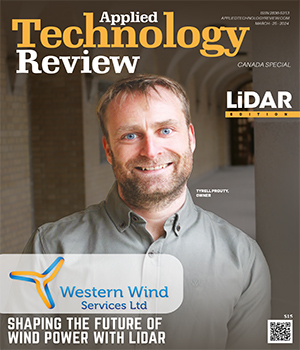
Western Wind Services: Shaping the Future of Wind Power with LIDAR

Top 10 LiDAR Solutions Companies in Canada - 2024

In the ever-evolving landscape of technological innovation, few domains have witnessed as dramatic a transformation as LiDAR (Light Detection and Ranging) technology. Once confined to niche applications in topography mapping and remote sensing, LiDAR has now emerged as a cornerstone of numerous industries, from autonomous vehicles to urban planning and beyond. With each passing year, breakthroughs in LiDAR technology continue to redefine what’s possible, propelling us toward a future characterized by unprecedented precision, efficiency, and safety.

The latest strides in the LiDAR technology space are nothing short of revolutionary, offering a glimpse into the next generation of sensor capabilities and applications. At the forefront of these advancements is the push for enhanced resolution and range, two critical parameters that underpin the efficacy of LiDAR systems across various domains.

One of the most significant developments in recent times is the refinement of solid-state LiDAR solutions. Traditionally, LiDAR systems relied on complex mechanical components to steer laser beams and capture three-dimensional data. However, solid-state LiDAR eschews moving parts in favor of compact, semiconductor-based architectures, resulting in greater reliability, durability, and cost-effectiveness. By harnessing the power of microelectromechanical systems (MEMS) and advanced photonics, these next-generation sensors promise to unlock new frontiers in autonomous navigation, augmented reality, and beyond.

However, amid the excitement surrounding these advancements, it’s essential to acknowledge the ongoing challenges facing the LiDAR industry. Concerns related to data privacy, regulatory compliance, and environmental impact must be addressed proactively to ensure the responsible and ethical deployment of LiDAR technology at scale. Moreover, efforts to standardize interoperability and data exchange formats are critical to fostering seamless integration and collaboration across disparate LiDAR systems and applications.

In this edition, we have featured Western Wind Services. The company takes advantage of LiDAR’s indispensable role in wind resource assessments to offer affordable, name-brand LiDAR equipment to different wind power stakeholders across Canada, ranging from developers and consultants to operators and farms.  

    Top LiDAR Solutions Companies in Canada

  • Western Wind Services stands out for its specialized focus on providing remote sensing solutions, particularly LiDAR, to the wind industry in Canada. The combination of comprehensive services, affordability, and a commitment to staying technologically current contribute to the company's uniqueness in the market.

    www.westernwindservices.com

  • 3DS Technologies

    3DS Technologies

    3DS Technologies is a consulting and 3D Laser scanning company using the most up to date equipment and technology. 3DS Technologies delivers a detailed, as-built representation of a facade, space or area with 3D data for integration into Building Information Modelling (BIM), real-time planning of a build, or architecture projects with fast and accurate deliverables.

  • Airborne Imaging

    Airborne Imaging

    Airborne Imaging is a leading provider of geospatial services using aerial LiDAR and NADIR imaging sensors, to help map assets and critical infrastructure across North America. They combine proven technology with their vast experience and methodologies to capture, process and evaluate LiDAR and imagery data to the highest quality levels and standards.

  • AltoMaxx Technologies

    AltoMaxx Technologies

    AltoMaxx works alongside their partners and clients to realize the incredible potential of drone technology. It’s their goal to drive the RPAS industry forward-by providing their clients and partners with the best tools and technical services in the world. They deliver comprehensive end-to-end solutions across industries and geographies to realize the possibilities of drone technology.

  • Candrone

    Candrone

    Candrone is a solutions integrator for custom robotics, hardware and software that provides a wide scope of services including sales, training, rentals, maintenance, flying and data processing services. Candrone is a subsidiary of a parent company has been in business for over a decade, specializing in flying heavy payloads on custom built UAV’s. They are system integrators that have a strong focus on business to business sales and service.

  • Eagle Mapping

    Eagle Mapping

    Eagle Mapping provides digital topographical and digital orthophoto mapping from aerial photography, LiDAR and satellite imagery. Their focus has been providing custom accurrate geospatial and mapping solutions to meet their client’s needs - now and into the future.

  • Geomount

    Geomount

    Geomount specializes in merging geospatial intelligence (GEOAI) and mapping technologies to create innovative applications. Their mission is to transform imaginative geospatial and virtual engineering solutions into reality within the economic and developmental constraints of the clients. Specializing in merging geospatial intelligence (GEOAI) and mapping technologies, they empower professionals to optimize project plans effectively.

  • ITF Technologies

    ITF Technologies

    Powered by ITF Technologies’ years of experience in fiber laser and telecom component design, comes their LiDAR laser source, a 1550nm laser made with self-driving vehicle LIDARs in mind. With high performance, compact design and adaptable control electronics, they offer a solution exceeding the requirements for clients LIDAR system.

  • Landmark Surveys & Engineering

    Landmark Surveys & Engineering

    Landmark offers specialized services in legal land surveying, UAV LiDAR & photogrammetry, marine hydrography, terrestrial LiDAR scanning, construction layout, topographic surveys, dimensional control, precision surveying, drafting, GIS, and general survey consulting. They provide legal land surveying for private residential, commercial, Crown Lands, cabin lots, subdivisions, and geomatics engineering solutions.

  • RockMass Technologies

    RockMass Technologies

    RockMass Technologies is revolutionizing structural mapping by developing a data collection tool made for geologists. The company creates data collection more efficient, accurate and safe for geologists in mining, exploration, civil engineering and education. At RockMass, their goal is to improve geological mapping in the mining, civil engineering,and exploration industries with their revolutionary mapping technologies.

follow on linkedin
Copyright © 2025 Applied Technology Review.All Rights Reserved
Top